Our Mission

Paulding County Amateur Radio Emergency Service (ARES) is
more...

Resources

Information, procedures, links, supporting documents
more...

Gallery

We let our actions speak for us.
more...

Join Us

Click here to view the PCARES membership application.
more...

Latest News

Current List of Executive Orders

Please refer to this website for a complete list of Executive Orders signed by Gov. Kemp. This list includes the most current Executive Orders that pertain to COVID-19. This an ever changing list, so please be sure to check often.


National Hurricane Center

2022 Atlantic Hurricane Season Outlook

Below are additional webinar recordings from NOAA regarding the 2016 hurricane season, as well as some general information behind the forecasting of hurricanes.

Hurricane Model Research and Application in NOAA

NHC Hurricane Specialist Michael Brennan and AOML Hurricane researcher Frank Marks conducted a webinar on May 10th, 2016, sponsored by NOAA’s Southeast and Caribbean Regional Team. Michael explained how NHC forecasters use model guidance, and explained the caveats forecasters must consider when they rely on this guidance to create the official forecast. Recording of webinar

NOAA’s National Hurricane Center Product Updates

Dr. Rick Knabb, Director of NOAA’s National Hurricane Center (NHC), provided an overview of the threats and historic losses associated with hurricane landfall in the US, underscoring the need for timely warnings and preparations in advance of hurricanes. The latest NHC storm surge products were introduced and tropical cyclone product changes planned for the 2017 hurricane season were previewed. Recording of webinar

Storm Surge Forecasting at NOAA’s National Hurricane Center

Hurricane Specialist Robbie Berg from NOAA’s National Hurricane Center (NHC) discussed new products that convey the risk of storm surge from tropical cyclones. Robbie provided an overview of the newest forecast product, the Potential Storm Surge Flooding Map, as well as the Prototype Storm Surge Watch/Warning Graphic that debuted during the 2015 hurricane season. Recording of webinar

All of these recordings, as well as future recordings can be found at the NOAA Southeast and Caribbean website.


Spotter Reporting Criteria - IMPORTANT

bad

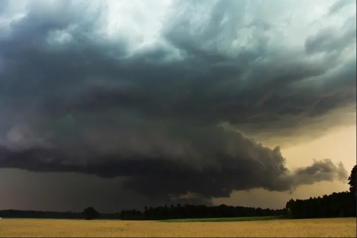
When making storm reports to the Net, please follow the below Reporting Criteria unless instructed otherwise by Net Control.

Minimum Severe Reporting Criteria

  • All tornado, wall cloud, etc
  • All hail reports allowed
  • Only wind speeds and/or gusts greater than 50 mph
  • All severe hydro related events (flooding, flash flood, etc)
  • All notable damage generated from a storm
  • All winter reports, IF they have a significant impact
  • All tropical reports, IF they have a significant impact

Refer to SKYWARN Reporting Criteria

What is NOT allowed (unless otherwise requested by Net Control)

  • No test reports.
  • No lightning reports
  • No "sky is clear" reports
  • No "storm is getting stronger/weaker" reports
  • No fog reports
  • No radar based reports
  • No reports of what you are hearing on scanner-ham radio-TV
  • No rain measurements unless you believe it constitutes flood conditions.
    Use CoCoRaHS for precip reports!
  • No snow measurements unless you believe it constitutes a dangerous situation
  • No general information like "storm is passing the Georgia border"
Refer to SKYWARN Report
Refer to Weather Spotter’s Field Guide


QSO - Let's Hear From You

We are a growing team of Amateur Radio Operators dedicated to Amateur Radio Emergency Service. We are dedicated to emergency backup support for local and state agencies. We train for any emergency.

If you would like more information, please contact us:

USPS: Paulding County ARES, 1124 Regiment Drive, Acworth, GA, 30101
Email: info at pauldingares.com

Paulding County ARES